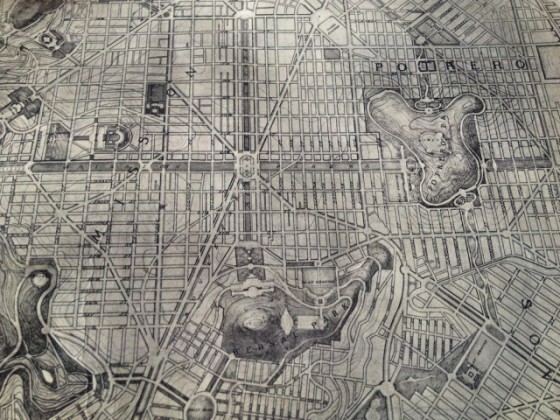
That strip of parkland between Mission Street and South Van Ness was gonna be called “Mission Arcade.” And the one running east-west was “Mission Parkway.” And how helpful would those diagonals be when biking from Dear Mom to El Rio??
Bernalwood dug this up; here’s the story:
A few weeks ago, I took Bernalwood’s Cub Reporter to visit the new Exploratorium. While we were there, we wandered down a long hallway and into the Bay Observatory Gallery at the northeast corner of the museum. And in the Bay Observatory Gallery, we found a very cool collection of maps [...]
[T]he Cub Reporter was fascinated with a map visualization created by the amazing Eric Fischer (which quite speaks well of her).
Simultaneously, your Bernalwood editor was intrigued by a map of an ambitious redevelopment plan that envisioned San Francisco as a kind of Paris by the Bay, with grand boulevards and ornate gardens slicing through our familiar street grid.
Read on for a bunch more maps and history.
Now let’s rock out:

it sounds like an elaborate gentrification scheme. good thing this evil was stopped!