121 Year Old Route Resurrected

In 1894 the Pullman Strike cut San Francisco off from all physical communication.

From the San Francisco Examiner on July 7, 1894:

“An enterprising citizen of Fresno has organized a bicycle mail relay from that city to San Francisco to carry letters only. The route taken is west to Gilroy, then north through San Jose to this city.”

For $0.25 you could have a letter carried relay style from a bike shop in San Francisco all the way to a bike shop in Fresno. From there, or 16 other cities along the route, the local post office could deliver your letter right to the recipient’s door.

This weekend the route will be recreated. All that’s left is to get some mail.

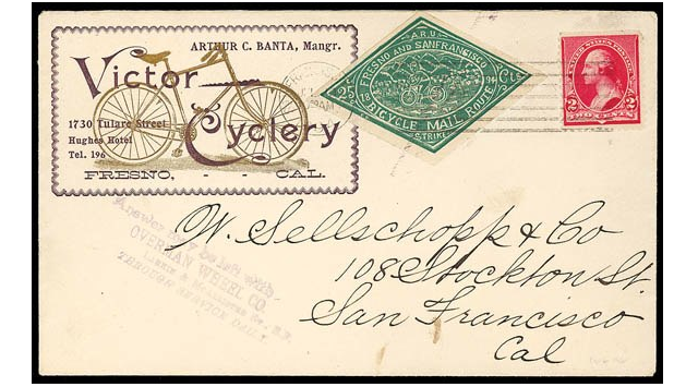
In 1894 each letter was carried on the backs of 8 different bike messengers over 210 miles. The journey took about 18 hours, riding single speed bikes on mostly unpaved roads.

800 stamps were produced so quickly that an glaring mistake was overlooked. San Francisco was misspelled San “Fransisco.”

Full story here: Ingenuity, Murder, Fraud and Fixies (San Francisco in 1894)

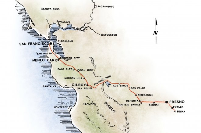
On Friday a small group of friends will commemorate this ride by departing from a bike shop in San Francisco and tracing the same route to Fresno. None of them are bike messengers, and in fact, this will be the longest ride of their lives.

All they need now is mail.

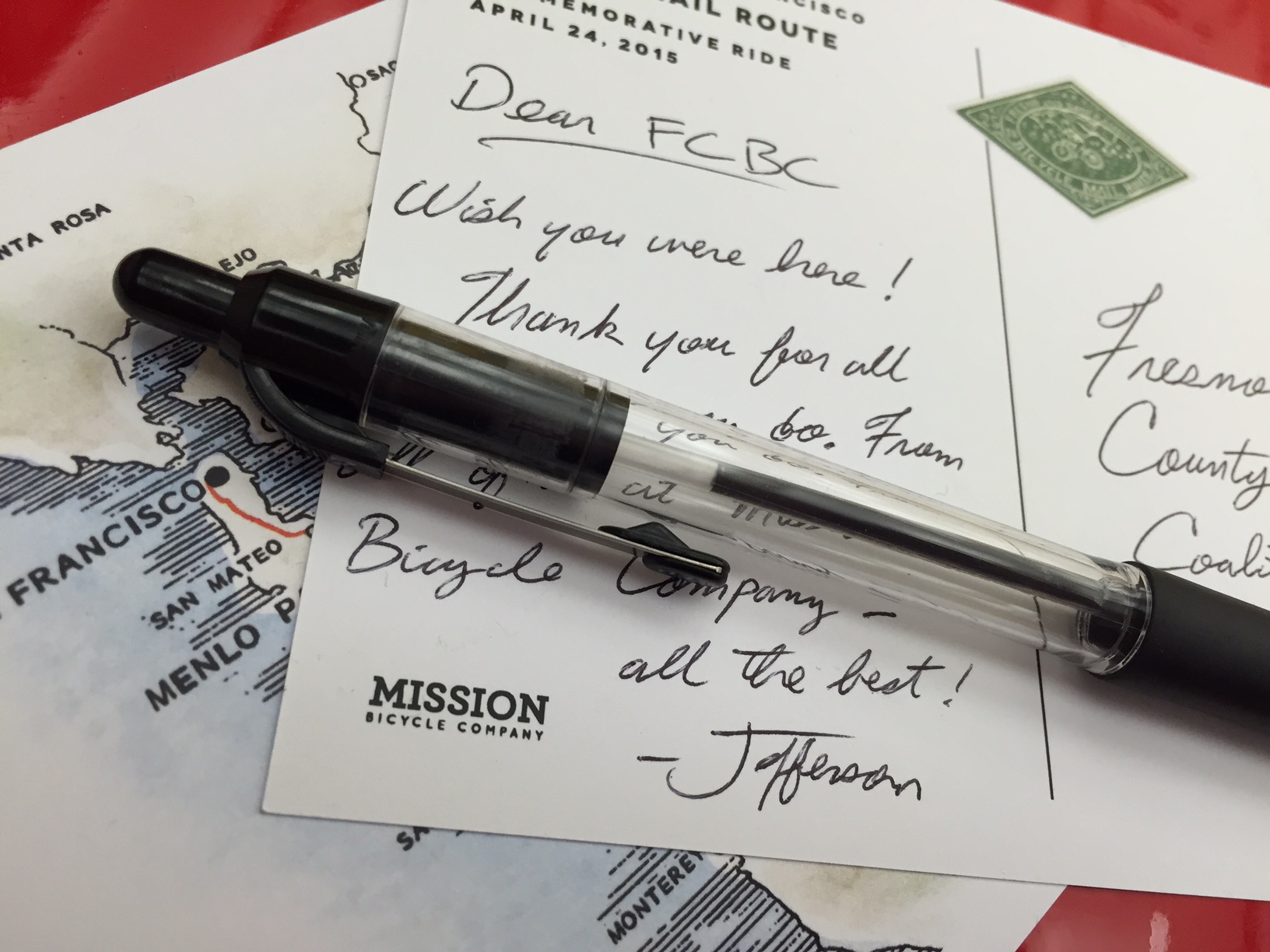
This is where you come in. Stop in Mission Bicycle Company any time between now and 6:00 pm on Friday night if you would like to send a commemorative postcard to anyone in Fresno.

Don’t have any friends in Fresno? The recreators will hand deliver a message to any of the following stops.

After 121 years, the price remains $0.25.

Clooney’s on the move (through space and time)

As many of us have suspected, the oddly-shaped Clooney’s generates its own space-time bubble. Fortunately we have managed to capture it in GIF format.

If you are not thoroughly confused on what you are seeing, you should be. Black and white = 1938 Clooney’s, color = 2012 Clooney’s. On different intersections.

Around 1951, the weirdly angled apartments atop Clooney’s were jacked up on a truck and moved to 25th & Valencia from 30th & San Jose Ave. The SFPL happens to have a picture of proto-Clooney’s from 1927.

Here’s another GIF that shows how San Jose Ave doubled in size westward — the southbound lanes ate the eastern side of the block.

Much more on the Cloonification of Valencia & 25th over on Burrito Justice, including the history of O’Reilly’s, the bar that predated Clooney’s back to the late 1800′s.

Travel and dine back in time

The esteemed time travel team at Pastmapper have released a little bit of history that you can hold in your hand — behold the Pastmapper iPhone app that lets you check into the ghosts of restaurants and bars past. The sixties welcomes you:

20120717-172049.jpg

20120717-174156.jpg

@bradvertising has started with 1966, with more years coming. But it’s fascinating to dig in and see what was where when. The Smile Awhile Tavern (aka proto-Farolito Bar) welcomes you:

20120717-175250.jpg

You get more points for checking in close to the place, but fret not, I will destroy you on the leaderboard.

Anyway, more detail over on Pastmapper, so turn on, check in, and drop a note.

’62 Mission, Proto-Farolito

The esteemed Eric Fischer brings us scans of BART plans from 1962. This shot looks south down (and under) 
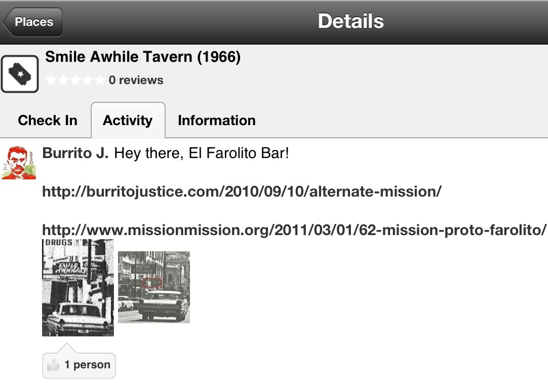
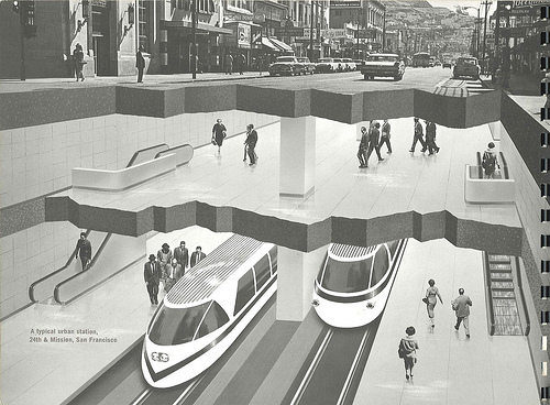
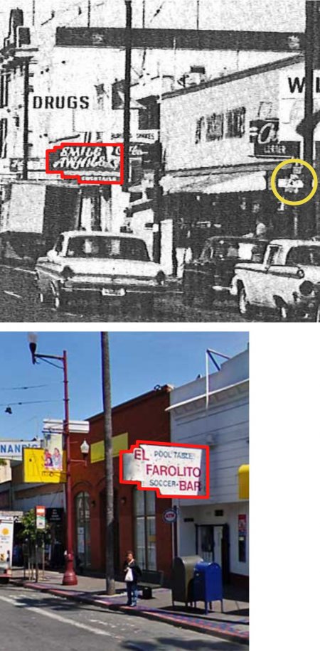
Mission from 23rd towards 24th:

The Look of Rapid Transit: 24th Street Mission station

The interesting part (outside of the fact that the BART station was to be so brilliantly lit that men wearing hats would cast stark shadows) is the street photo up top — it was taken from the NW corner of 23rd and Mission, looking south towards Bernal. (Click the image for a big-ass high resolution version.)

Particularly striking is the utter lack of trees (even on the slopes of Bernal).

Lots of donuts though:

Matching shot from today.  The trees make it hard to compare, but changes a plenty. (Click to enlargify.)

Zooming in towards 24th (above the epic car) we see the epic “Smile Awhile” bar:

A more clear view is available from the south.  It should quickly become clear what that sign represents today:

Much more on the history of 24th and Mission, both imagined and realized, over at Burrito Justice from a few months back.

New Mission vs The Fox?

(original photo via Telstar Logistics)

In the comment section of the Cinema Latino / Crown Theater article, reader “like a fox” brings us this interesting tidbit in my response to my plaintive wail, “Could you imagine something like Oakland’s The Fox in the Mission?”

Your wish is granted. The *other* theater across the street – New Mission – is slated to become a music venue – with the Fox being the model. Unfortunately, the New Mission doesn’t have the architectural splendor of the Fox. Don’t know how the funding or permitting is going, sorry.

Gus Murad’s club and height limits are well known, but the idea of a Fox-like entity in the Mission is a new one to me.  Any readers with more information?

(More Mission Street theater history porn here, and more pictures inside of New Mission here.)

Bicycle Regulations

While the city giveth us green bike lanes, they also taketh away: behold the bicycle crackdowns on the Wiggle.

The blossoming of bike lanes and Gavin with a paintbrush are great, but is the city now cracking down on cyclists? Junior seems to think so:

I’m kind of worried that they are a precursor to beginning widespread bicycle ticketing around the city.  You know, like back before the Critical Mass days.  I’m all for cyclists obeying the rules of the road, but the interpretation of those rules is at issue, and the price of those tickets has increased to around $300 nowadays, which can be the same as a paycheck!  But I try to stay out of politics . . .

And behold this ominous San Francisco bicycle ordinance!

Oh crap, that’s from 1903, sorry.  Scanologist Eric Fischer brings us this century old news.

But some things haven’t changed — sections 1-4 are regularly ignored in the Mission.  And as Eric notes, “Speed limit 6 mph. A $500 fine then would have been like $10,000 now.” We certainly would not have survived that era. (But we certainly need to bring back the practice of “scorching”. And I am going to work in “Machines of Similar Character” into everyday conversation.)

1895 regs — biggest difference is a concern about transporting children on bikes.

As for irony, the first “good roads” campaigns were pushed by cyclists in the late 19th century.

As bicycle outings surged in popularity, riders everywhere shared a common burden — hazardous roads. Soon [Albert] Pope began speaking across the country about the need for good roads. “The high point to be aimed at,” he said back in 1889, “is the recognition of the importance of the whole situation by the national government.”

Then Henry Ford came along.

Some historical context on the conditions of roads in the late 1800s is available in old San Francisco municipal reports.

The city struggled to keep up with the surge in popularity of bicycles. I found this 1894 report amusing.

BICYCLE ROAD EXTENSION

Your Commissioners have always borne in mind the fact that the public is made up of separate human beings with separate tastes, whose comfort and convenience demand regard.

Keeping this in view, the bicycle road was constructed last year exclusively for the use of patrons of the wheel, and a further extension of this road is proposed during the coming year to run parallel with the main drive.

The rapid development of the present interest in bicycling among all classes is something astonishing, and as the Park is a favorite haunt of the cyclists, it is incumbent upon your Commissioners to attend to their interests and wants.

That first line is pretty much SF in a nutshell.

Capp To The Future

Imagine an elevated train down 17th, and another down the center of Capp Street with half a block on either side torn down to make way for a six lane boulevard. This is what your great-grandparents were considering in 1930.

More details on 80 year old Mission retro-future rapid transit options over at Burrito Justice.

Major League Mission

Telstar Logistics. Laughing Squid. Burrito Justice. Mission Mission. What happens when they join forces? Mission Blog Force 2010! A veritable historical mapgasm ensues.

Laughing Squid and Telstar Logistics recently exposed us to the historical imagery feature in Google Earth.  San Francisco’s 1946 layer proved irresistible, especially concerning the old SF Seals baseball stadium, now home to the Potrero Safeway and Office Depot.

As is inevitable amongst map wonks, the Telstar Logistics and Burrito Justice mapping teams started to wonder exactly where in the stores the bases were located. The alignment of the 1947 photomap is a little wobbly in Google Earth (it’s off by 30-100 feet) so we turned to another favored source for greater precision, Sanborn maps overlaid in GE. Behold the diamond of history.

In the world’s first blogging simulcast, you can see the raw base photos of the Telstar Logistics Surveying Unit along with painfully detailed overlay maps by the Burrito Justice Research Department. Telstar Logistics historical analysis will be available on Laughing Squid posthaste.

For some perspective (because that’s how we roll) here’s opening day for the Giants in 1959, their first game against LA. That’s 16th on the top and Bryant on the right.

Note that history was made recording history: a blogger ACTUALLY LEFT HIS HOME and went on-site to determine that home plate and 1st are located in Office Depot, while 2nd and 3rd base in Safeway.

Below, blue tape marks third base, looking towards home plate.  (Torillas in front of you, and frozen pizzas behind you, as is so often the case when you’re trying to steal home.)

To make this post even more relevant to the Mission — Seals Stadium was also home to the Mission Reds (aka the Missions) before they moved down to Hollywood in 1938.

And prior to Seal Stadium’s construction in 1930, both teams played at 14th and Valencia at Recreation Park. Think of that next time you’re at Four Barrel.

More photos and maps at TL, LS, and BJ.

Drink Up, Nostalgiaholics! Historic Photos of the Mission

Electric streetcars braving a flood at 16th and Folsom circa 1905 (click to enlarge)
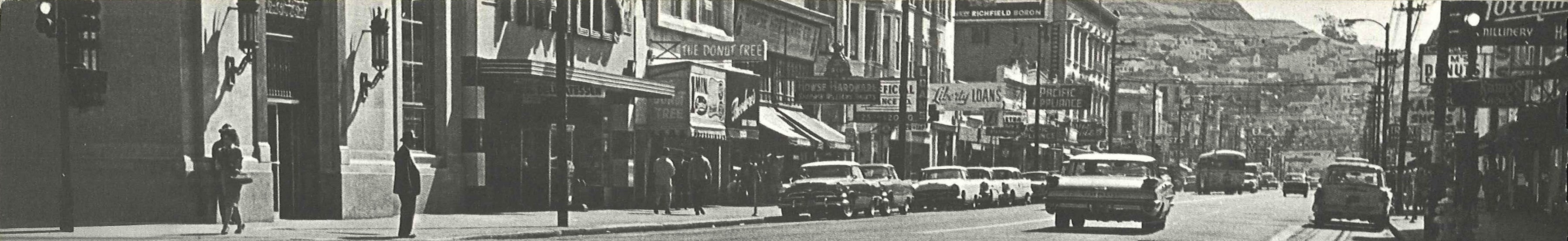
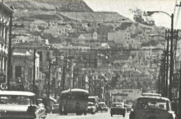
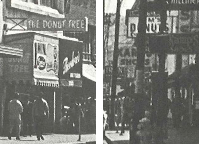
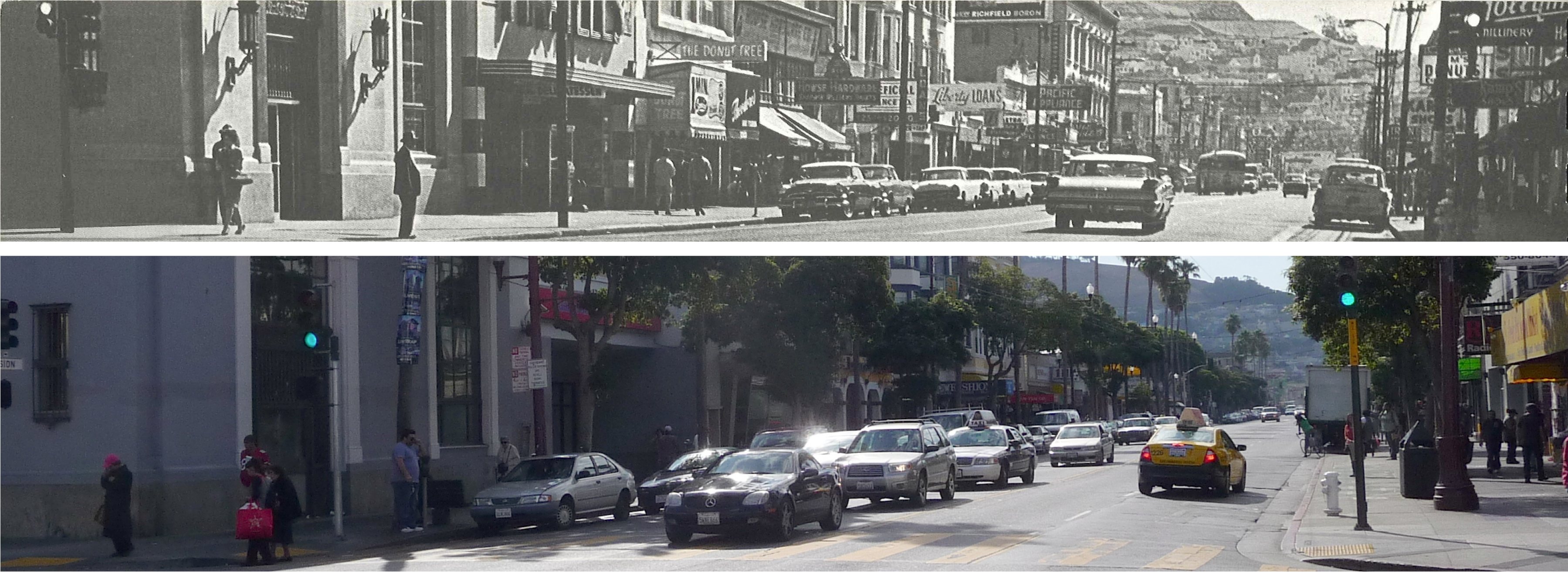
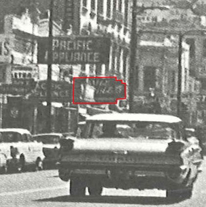
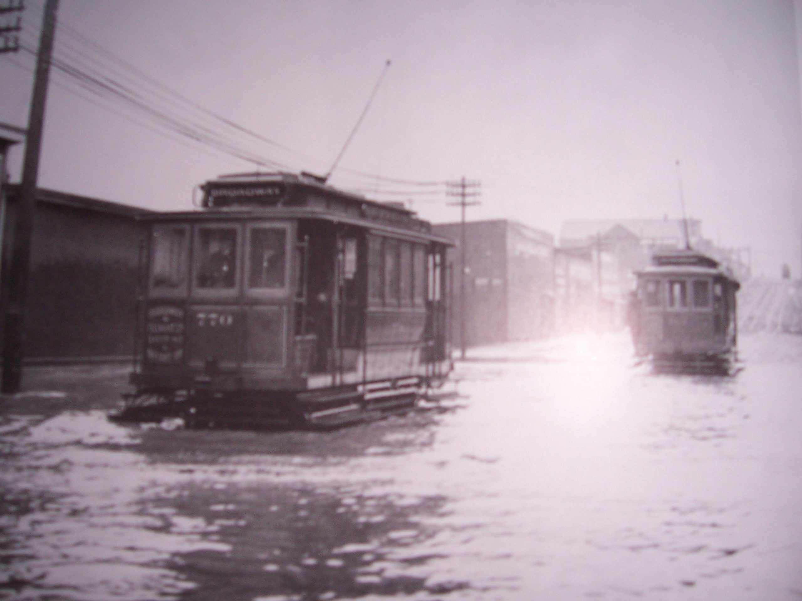
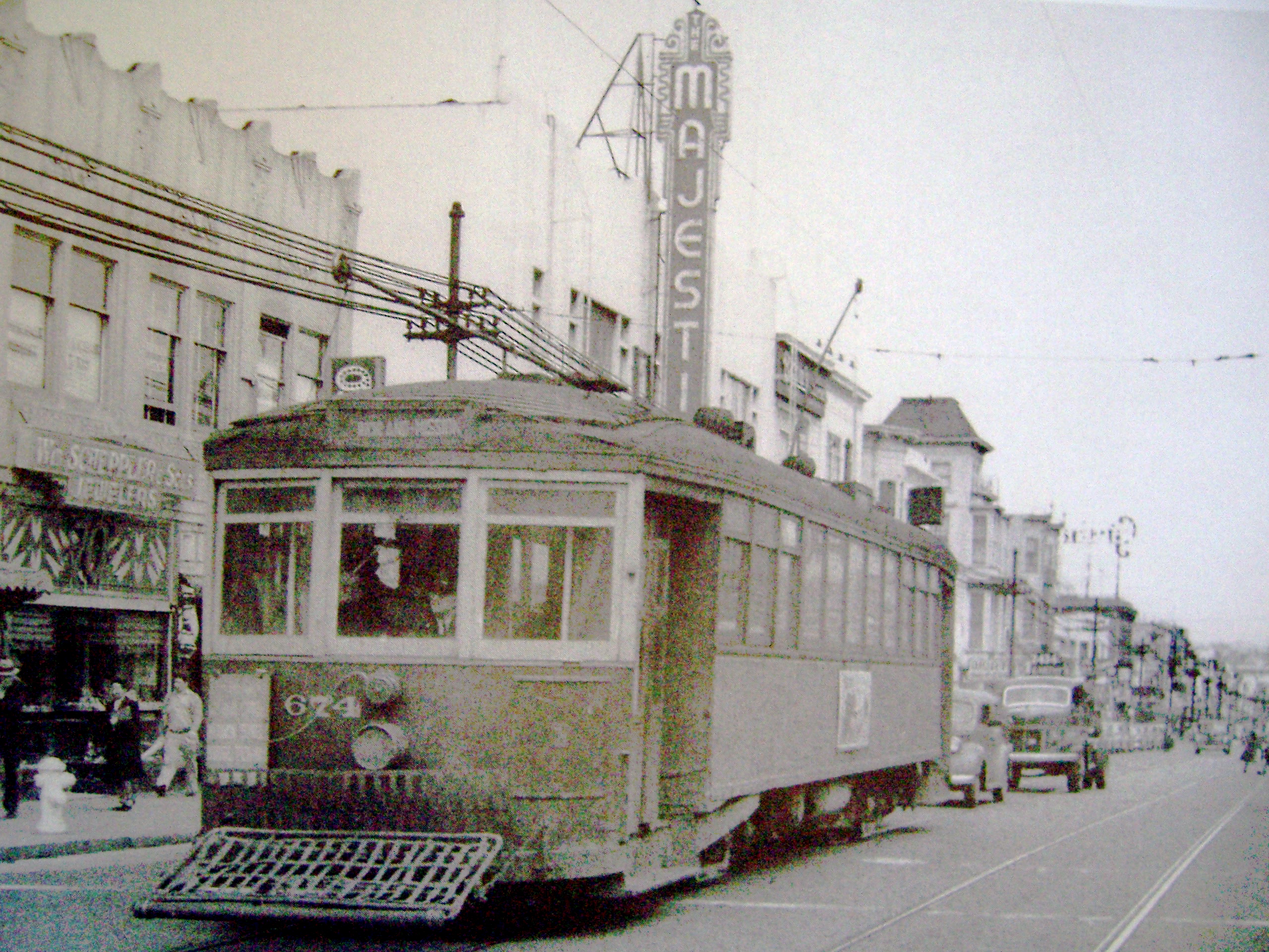
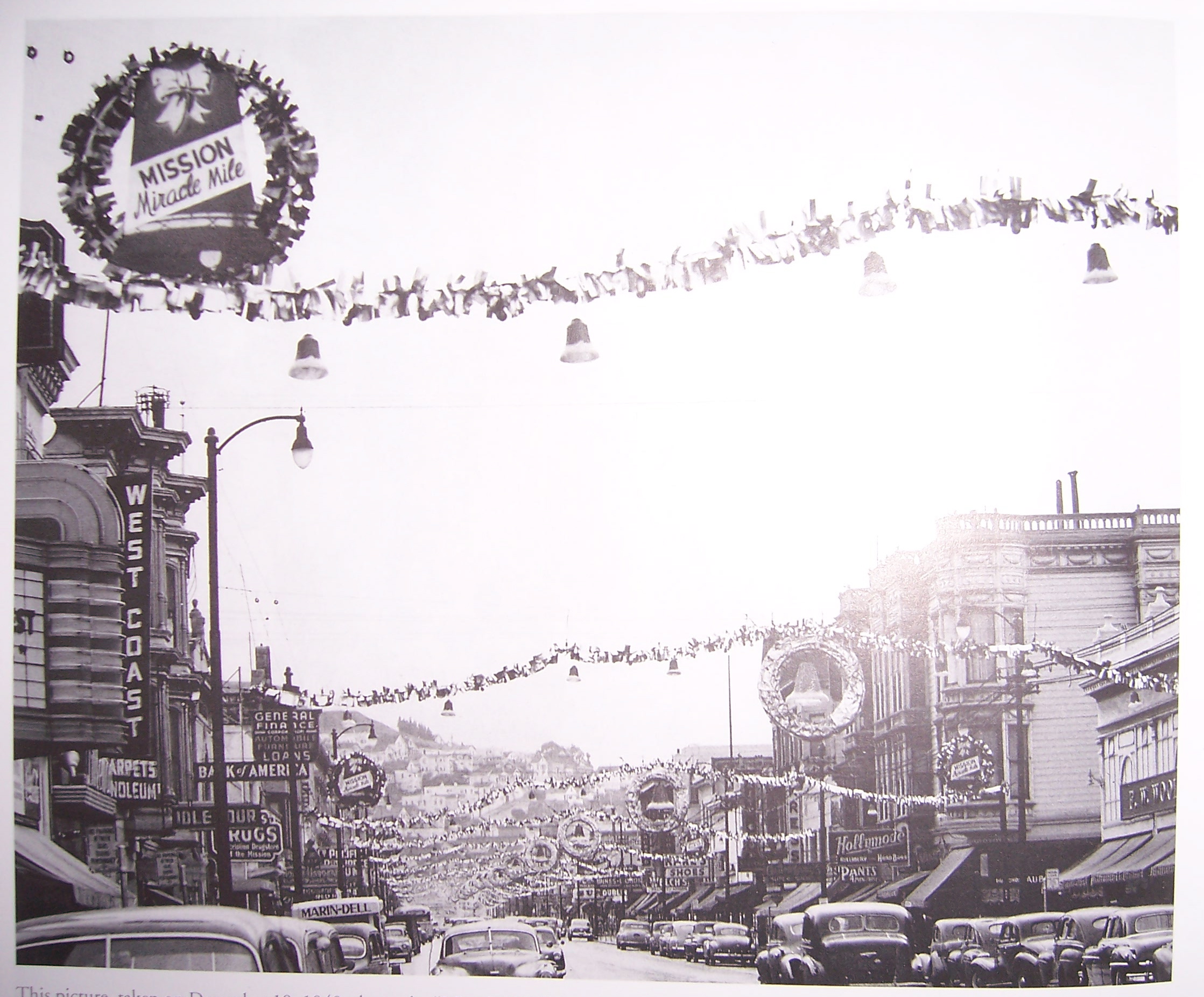
.

Hustle and bustle at 21st and Mission in the 1940s (click to enlarge).

All tarted up for Christmas (click to enlarge). Note the “Mission Miracle Mile” seasonal signage in the upper left. Should we start bounce house for sale calling it that again?

All these photos and more are collected in Historic Photos of San Francisco by historian Rebecca Schall. The author appears this Saturday at 3pm at the Fisherman’s Wharf Barnes & Noble. Stop by for more photos and history, or to find out about her time developing museum exhibits at Mission Dolores.